


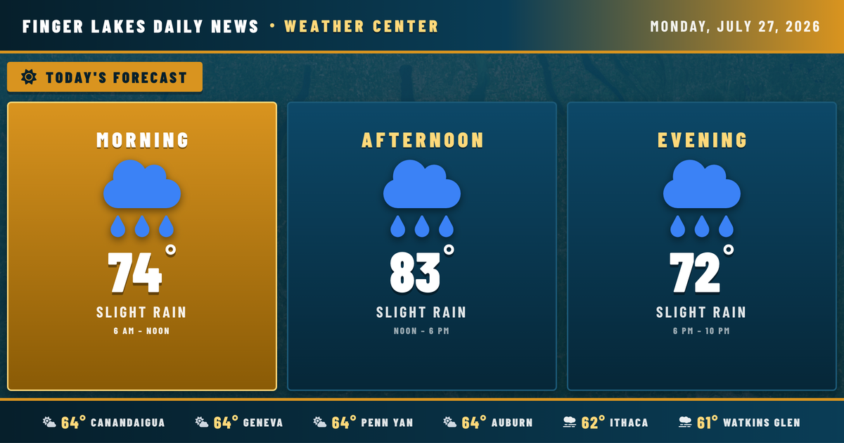
Dense fog is blanketing the southern valleys this morning — Watkins Glen, Corning, and Bath all sitting at saturation with temperatures in the low 60s, while Geneva, Auburn, and Penn Yan are waking up mainly clear but thick with humidity near 95%. Give yourself extra time on the roads until that fog lifts, likely by mid-morning as temperatures climb.
Today will feel like a slow build. Skies become partly to mostly cloudy through the morning as moisture deepens ahead of a shortwave trough dropping southeast across the Great Lakes. By early-to-mid afternoon, that combination of dew points in the 60s and daytime heating should be enough to fire showers and thunderstorms, particularly inland from lake breeze boundaries. The NWS notes better storm coverage today compared to the past weekend, with some storms capable of gusty winds and heavy rainfall. Highs reach the low-to-mid 80s — near 83° in Geneva and Canandaigua — before those storms arrive and knock temperatures back. Plan outdoor activities for the morning hours.
Evening brings continued storm chances as the trough pushes through, with activity gradually tapering toward midnight. Overnight lows settle near 64°.
The bigger rain story arrives Tuesday, when that surface low tracks across the central Great Lakes and widespread moderate to heavy rain is expected — Geneva’s forecast shows a 97% precipitation chance with a high of only 74°. Shower chances linger Wednesday and Thursday as the system slowly exits. By Friday, conditions finally dry out, with a return to the low 80s through the weekend.
Weather Center forecast for the Finger Lakes region. Sourced from NWS, Open-Meteo, NWS Area Forecast Discussion, and USGS stream-flow data. Updated 6 AM, noon, and 6 PM ET.