


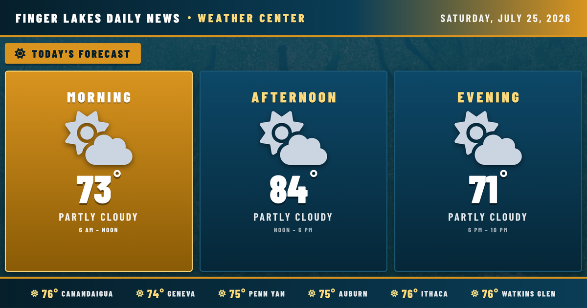
My radar and model screens are about as quiet as they get for late July — clear skies, light southerly winds, and the region already climbing through the mid-70s before 11 AM. Today is genuinely the pick of the next several days, and it’s worth knowing that before the forecast turns.
High pressure that delivered the region’s recent stretch of fine weather has slid east toward New England, according to the NWS Buffalo discussion. That southerly return flow is now feeding warmth and mid-level moisture back into the Finger Lakes, though the air is still dry enough that most of the region stays rain-free today. Highs will reach the low-to-mid 80s this afternoon — Geneva and Auburn topping near 84°, Ithaca and Canandaigua nudging closer to 85° or 86° under partly cloudy skies. Humidity stays manageable, with dew points in the low 60s — warm but not oppressive.
Evening stays comfortable through sunset at 8:36 PM, with temperatures easing into the upper 60s. Overnight lows settle near 61° in Geneva, a touch cooler in the southern valleys around Corning and Bath where readings may slip toward 56°.
The pattern shifts from there. Sunday brings the first real chance of showers and thunderstorms — the NWS specifically flags Sunday as the most active day of the stretch. Monday and Tuesday see increasing coverage of showers and storms as unsettled weather returns. By midweek, an upper-level trough sweeps through with a cooler airmass, pulling highs down to the upper 70s Tuesday and 75° by Wednesday. Thursday through Friday offer a partial clearing before the pattern likely resets. Enjoy today’s sunshine — it’s the last uninterrupted one for a while.
Weather Center forecast for the Finger Lakes region. Sourced from NWS, Open-Meteo, NWS Area Forecast Discussion, and USGS stream-flow data. Updated 6 AM, noon, and 6 PM ET.