


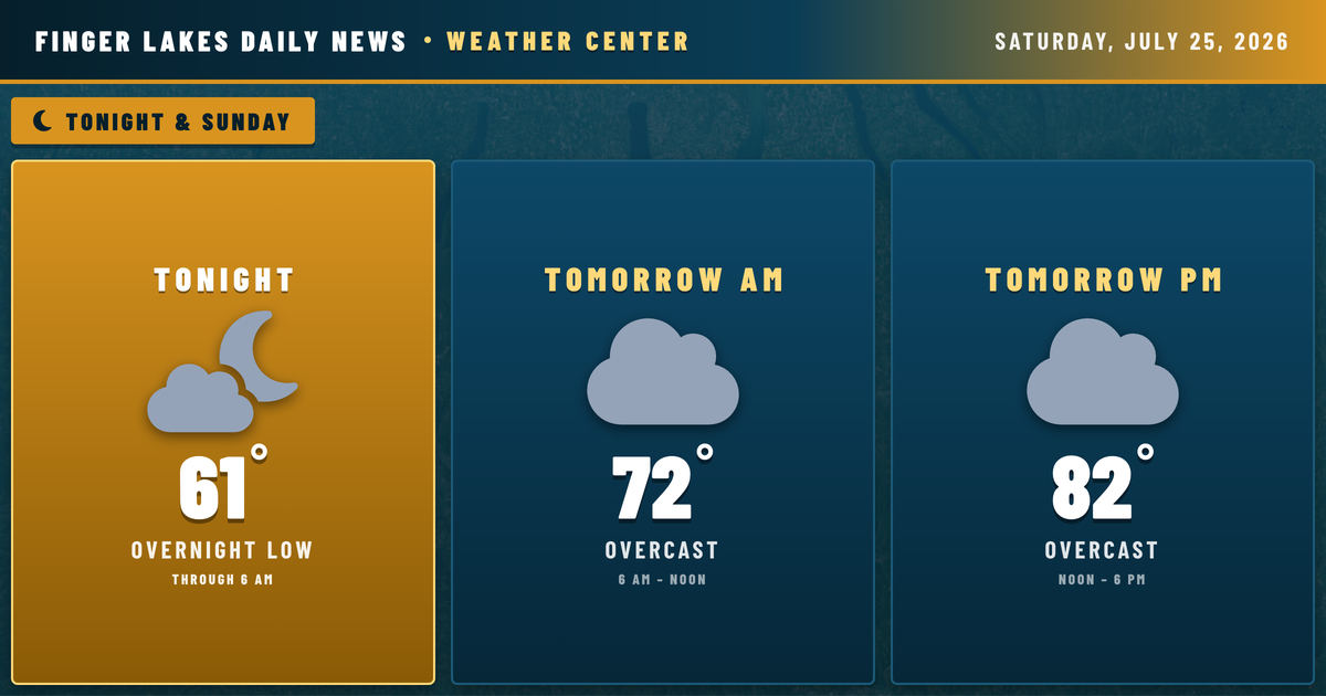
Tonight’s sunset is one worth catching — clear skies are spreading westward across the region as a mid-level trough pushes east of the Finger Lakes, and what’s left of today’s cloud cover should be gone well before midnight. Lows tonight will settle into the upper 50s to low 60s, ranging from around 58° in the Watkins Glen valley to 65° near Geneva, where Seneca Lake keeps temperatures from bottoming out. No frost risk, no alerts — just a quiet Saturday night with patchy fog possible in the southern valleys late.
Tomorrow brings another warm and comfortable day. Highs reach the low 80s under mostly cloudy skies, with only a 14% chance of a stray shower — that’s low enough to plan outdoor activities without much concern. Winds stay light out of the south at under 5 mph, and humidity remains manageable heading into the afternoon.
The bigger story develops through the week. Shower chances climb toward 45% by Monday night, then rain coverage surges to over 90% by Tuesday — the NWS forecasters in Buffalo are tracking an unsettled pattern with increasing coverage of showers and thunderstorms Monday through Wednesday. Tuesday’s high drops to 76°, and Wednesday dips further to 73° with moderate drizzle lingering. Drier conditions gradually return late in the week, with skies clearing by Friday ahead of an 81° day next Saturday.
Weather Center forecast for the Finger Lakes region. Sourced from NWS, Open-Meteo, NWS Area Forecast Discussion, and USGS stream-flow data. Updated 6 AM, noon, and 6 PM ET.