


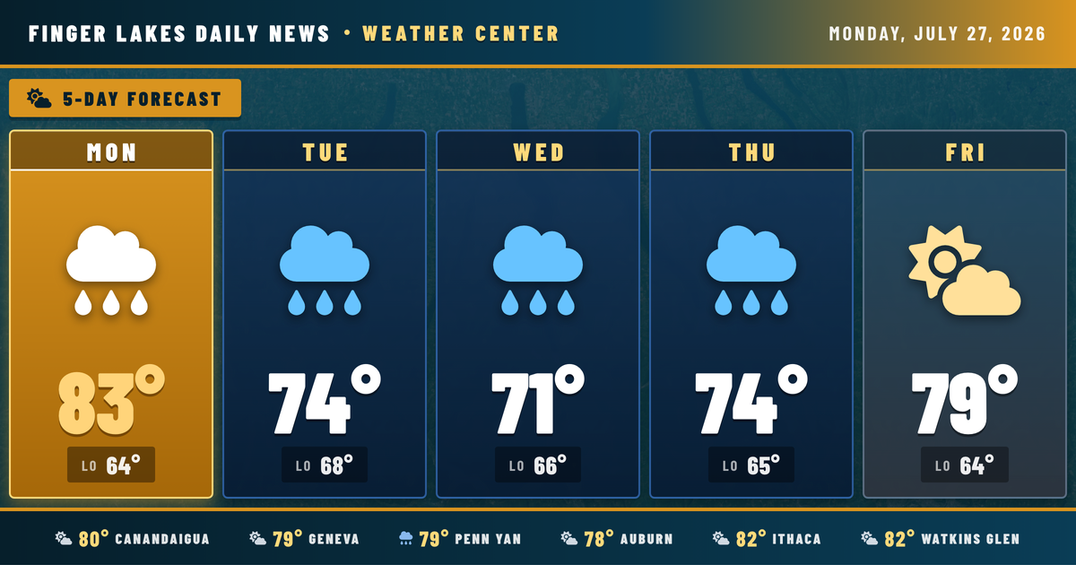
The afternoon is shaping up nicely across the region — Geneva sitting at 79°F under mainly clear skies at midday, with Watkins Glen and Ithaca already pushing into the low 80s. The day is on track and no alerts are in effect.
Enjoy the sunshine while it lasts. The NWS Buffalo office flags increasing storm coverage developing this afternoon into tonight as a shortwave trough dives southeast across the Great Lakes — higher atmospheric energy today compared to the weekend means better odds of seeing actual showers and thunderstorms, some capable of gusty winds and heavy rainfall. Canandaigua and Auburn could see activity develop inland from lake breeze boundaries by mid-to-late afternoon.
The wetter stretch extends through Wednesday, with Tuesday and Wednesday carrying the highest rain chances — Geneva’s forecast shows 61% Tuesday and 92% Wednesday. Things begin to dry out by Thursday, and Friday through Saturday look mainly clear before another round of clouds and drizzle arrives Sunday.
Weather Center forecast for the Finger Lakes region. Sourced from NWS, Open-Meteo, NWS Area Forecast Discussion, and USGS stream-flow data. Updated 6 AM, noon, and 6 PM ET.