


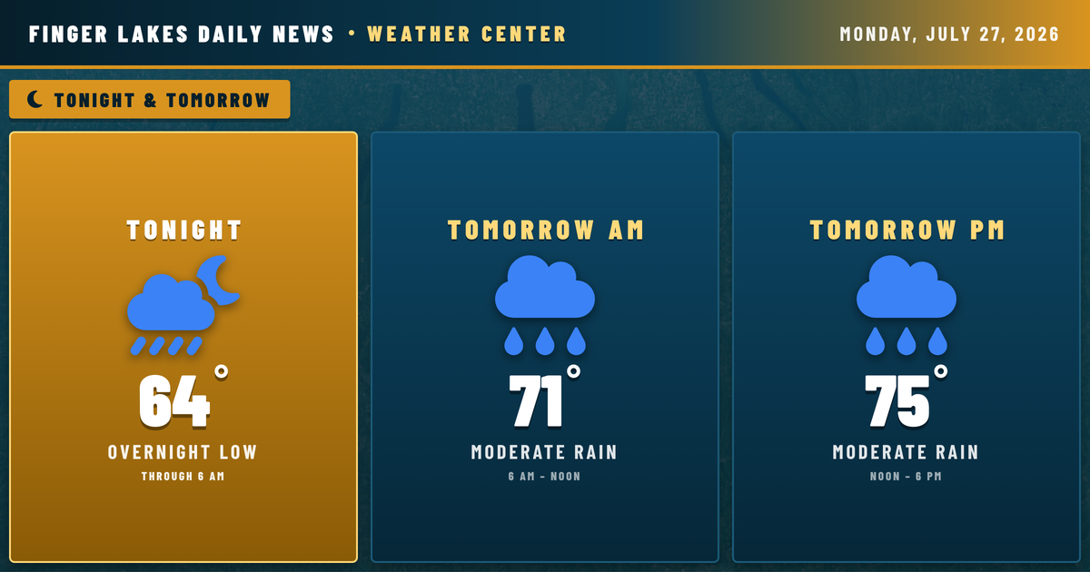
A slow-moving low out of the Great Lakes is about to change the complexion of the week considerably. Geneva is already picking up light drizzle at 71°F as midnight approaches, and what’s coming overnight is a more organized push of moisture — the NWS Buffalo office is tracking a surface low moving across the central Great Lakes tonight, dragging a corridor of high atmospheric moisture into western New York.
Overnight lows will hold in the mid 60s regionwide, so no frost risk — actually quite mild. The bigger story is Tuesday’s setup: Canandaigua, Ithaca, and Auburn should expect moderate to heavy rain during the day, with locally gusty winds possible during any stronger cells. High temperatures Tuesday will reach only the mid 70s — about ten degrees cooler than today’s 83–85°F range across the region.
The wet pattern persists through Wednesday and into Thursday before drier air finally filters in by Friday. Precipitation chances of 70–85% Tuesday through Wednesday mean this is a multi-day soaking, and the NWS notes heavy downpours are the primary concern, with localized gusty winds a secondary risk. Stream flows are currently at normal seasonal levels across the region, but multiple rounds of rain could push Seneca River and Cayuga Inlet flows upward by midweek. Worth monitoring.
Weather Center forecast for the Finger Lakes region. Sourced from NWS, Open-Meteo, NWS Area Forecast Discussion, and USGS stream-flow data. Updated 6 AM, noon, and 6 PM ET.