


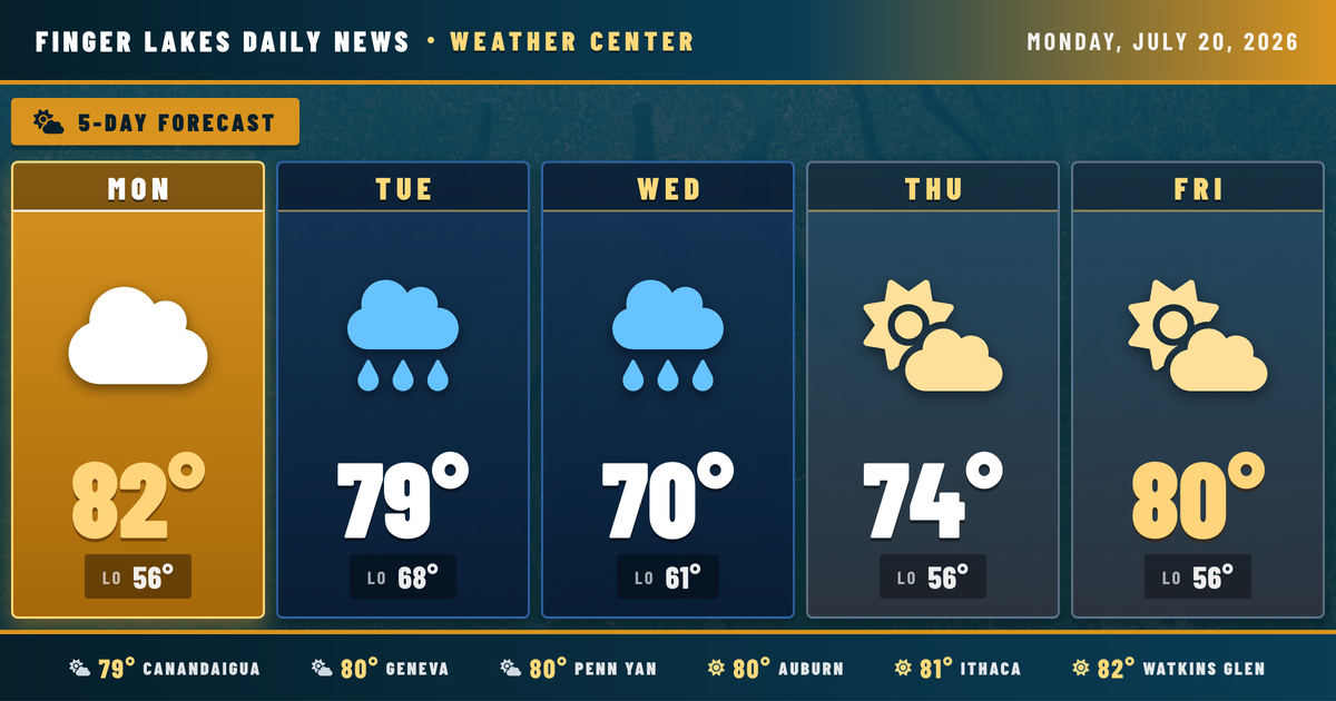
Tonight’s calm is a bit of a last hurrah — a strong cold front is bearing down on the Great Lakes, and Tuesday into Tuesday night is shaping up as the most active weather day of the week. Right now, conditions are genuinely pleasant across the region: Geneva is sitting at 80°F under mainly clear skies, Watkins Glen leads the pack at 82°F, and humidity is comfortable enough that the evening feels more like early fall than midsummer. Enjoy it.
By Tuesday morning, southwesterly flow ahead of the approaching trough will pump moisture back into the region — NWS Buffalo expects surface dewpoints climbing into the mid to upper 60s by midday. Scattered showers and debris clouds from overnight convection upstream may cross the area through the morning hours, and if that coverage persists, it could limit storm organization later. Still, the large-scale setup is favorable for severe thunderstorms Tuesday afternoon and evening, with strong wind shear supporting the threat. Stay weather-aware through Tuesday night.
Cooler and much quieter Wednesday, with highs only near 70°F and a chance of isolated lingering showers. Thursday clears out, and the back half of the week looks dry and pleasant — highs recovering to the lower 80s by the weekend.
Weather Center forecast for the Finger Lakes region. Sourced from NWS, Open-Meteo, NWS Area Forecast Discussion, and USGS stream-flow data. Updated 6 AM, noon, and 6 PM ET.