


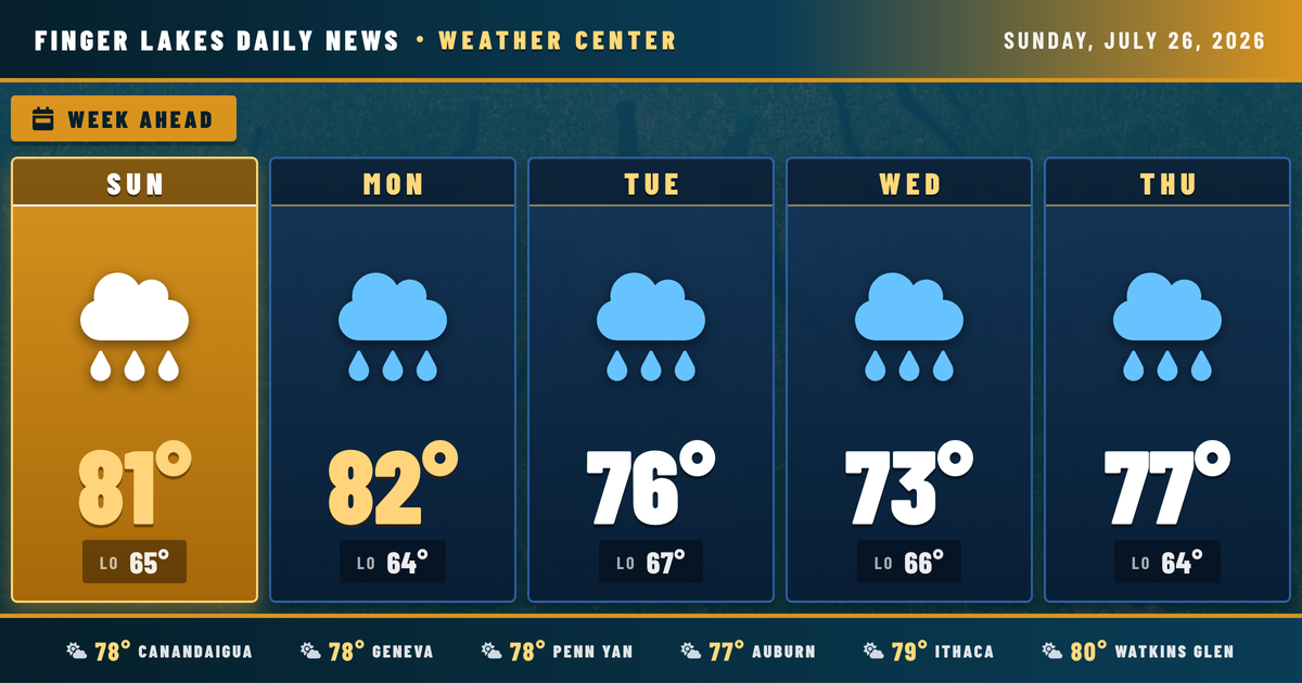
Sunday at noon looks better than the week ahead deserves — Watkins Glen already touching 80°F under mainly clear skies, and the rest of the region sitting in the upper 70s heading into the warmest part of the afternoon. Highs top out near 81° to 83° across the lakes, with Canandaigua and Penn Yan staying a touch drier in feel despite similar temperatures.
No alerts in effect, but the quiet doesn’t last. A disturbance pushing into the eastern Great Lakes this afternoon could spark a few scattered showers or a rumble of thunder before dark, particularly across interior areas. Moisture increases noticeably overnight into Monday, when a broad upper-level trough parks over the region and multiple disturbances ripple through it. By Tuesday and Wednesday, shower and thunderstorm coverage expands significantly — Tuesday’s forecast already showing a 91% precipitation chance for Geneva with highs dropping into the mid-70s. Thursday brings some improvement, and the weekend looks partly cloudy with highs rebounding to the low 80s.
Weather Center forecast for the Finger Lakes region. Sourced from NWS, Open-Meteo, NWS Area Forecast Discussion, and USGS stream-flow data. Updated 6 AM, noon, and 6 PM ET.