


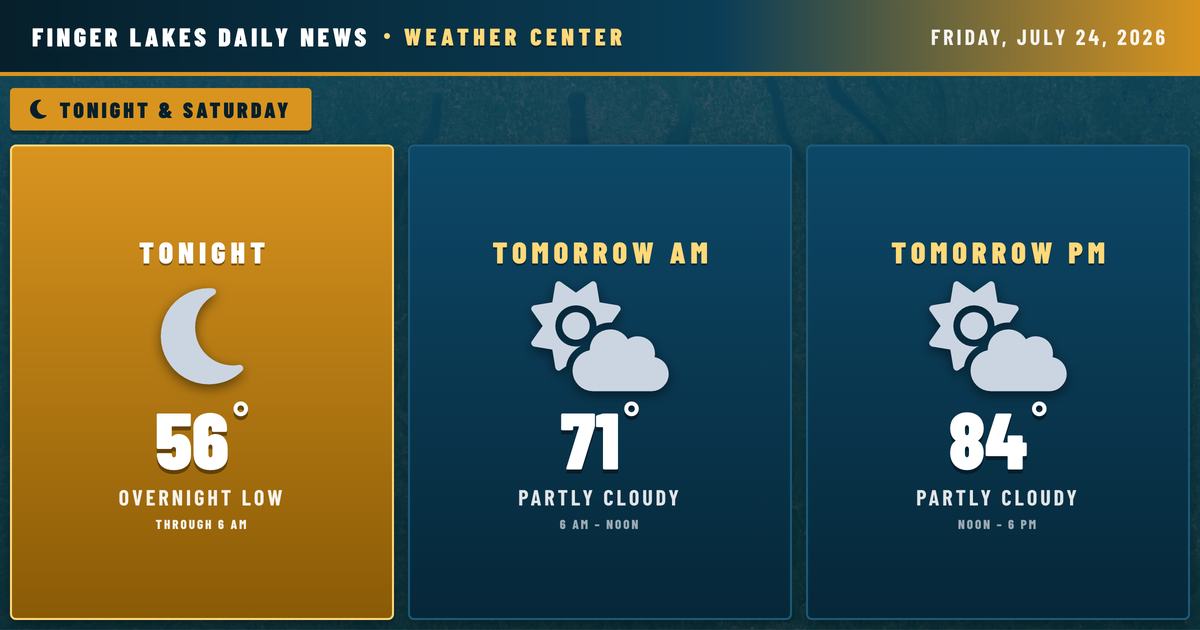
The region is winding down a genuinely nice Friday — skies have stayed clear all day, and that pleasant stretch isn’t done yet. Tonight looks equally quiet, with lows settling into the mid-50s across most of the region and upper 50s in the Ithaca and Geneva corridors where lake influence keeps things a touch warmer. The southern valleys around Corning and Elmira, already in the low-to-mid 40s humidity-wise, will see the most efficient radiational cooling overnight — expect patchy valley fog there through Saturday morning, a common summertime signature when high pressure parks overhead and winds go nearly calm.
No frost risk, no alerts in effect. This one is straightforward.
Tomorrow shapes up well. Partly cloudy skies, a high near 84°, and only a 2% precipitation chance through most of the day. The NWS does flag an isolated afternoon shower or thunderstorm possibility for the western Southern Tier late Saturday, tied to a weak mid-level trough interacting with lake breeze boundaries — but coverage would be very limited, and the Finger Lakes core looks to stay dry. Confidence in a dry Saturday for Geneva, Canandaigua, and Auburn is high.
The pattern shifts heading into next week. Drizzle chances climb Sunday through Tuesday, with Monday and Tuesday bringing the most consistent rainfall of the stretch — coverage at 66–71% by late in the period. Highs ease from the mid-80s tomorrow into the upper 70s by Tuesday, a modest cool-down rather than a dramatic one.
Weather Center forecast for the Finger Lakes region. Sourced from NWS, Open-Meteo, NWS Area Forecast Discussion, and USGS stream-flow data. Updated 6 AM, noon, and 6 PM ET.