


Stepping out this morning, the southern valleys are putting up some of the best numbers of the season — Bath and Corning sitting at 51°F under clear skies with calm winds, the result of a high-pressure center parked right over the region and overnight radiational cooling doing its thing. It’s a beautiful start to a Friday, and the day only gets better from here.
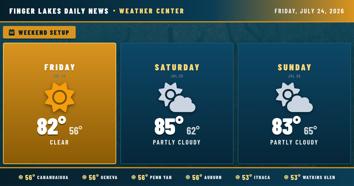
High pressure keeps skies mostly clear through the morning hours, with temperatures climbing steadily through the 60s and into the 70s by midday. Afternoon highs reach the low 80s across most of the region — Geneva and Auburn topping out near 82°, Ithaca and Watkins Glen potentially pushing a degree or two warmer toward 85° and 86° respectively. Dewpoints stay in the upper 50s, so despite the warmth, it won’t feel oppressive. Winds remain light throughout, generally under 5 mph from the south and southwest. Sunset arrives at 8:37 PM, and overnight lows drop back to the mid-50s under clear skies.
Saturday warms things up a notch — highs approaching the mid-80s — though a small chance of a shower or thunderstorm exists Saturday afternoon, mainly tied to a Lake Erie lake breeze. Most of the region stays dry. The bigger change arrives Sunday, when a series of weather disturbances pushes unsettled conditions back into the Finger Lakes. That pattern deepens into early next week, with drizzle and moderate rain chances running through Monday and Tuesday, highs easing into the upper 70s. By Thursday, skies begin to clear again, with highs back near 79°.
Weather Center forecast for the Finger Lakes region. Sourced from NWS, Open-Meteo, NWS Area Forecast Discussion, and USGS stream-flow data. Updated 6 AM, noon, and 6 PM ET.