


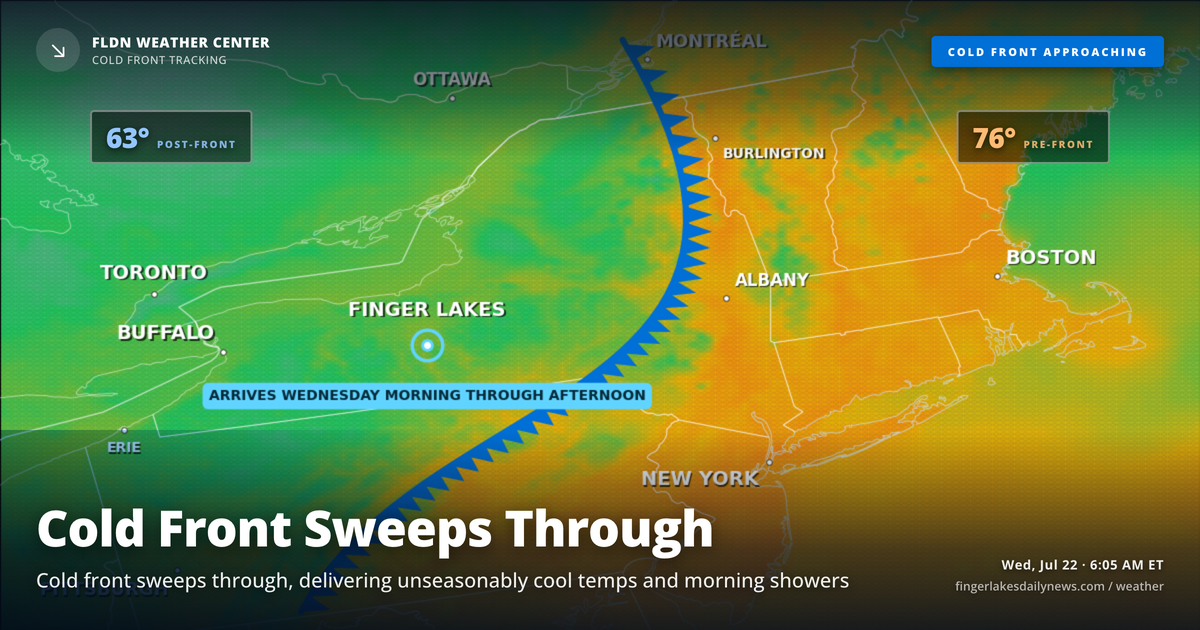
That west-northwest wind already biting at 62 degrees in Geneva this morning tells the story — the cold front the Weather Center has been tracking all week is crossing the eastern Great Lakes right now, and the airmass behind it is unusually cold for late July. According to the NWS Buffalo forecast discussion, temperatures at 850 millibars are expected to fall to levels near the daily minimum for this time of year, which is why today’s highs will feel more like early October than midsummer.
Morning hours bring the most unsettled conditions. Ithaca is already seeing light drizzle at 64 degrees, and scattered showers — with an isolated thunderstorm possible — will push east-southeast through midmorning as the front clears the region. Lake enhancement from the Finger Lakes and the larger Great Lakes will focus showers and low clouds across the eastern portions of the forecast area, so Auburn and points east may see more persistent drizzle into the early afternoon.
Skies begin to improve from west to east through the afternoon. Geneva, Canandaigua, and Watkins Glen should see conditions brighten first, with highs struggling into the upper 60s to low 70s. Corning and Elmira may reach the low 70s as the front pulls well to the east. High pressure builds in tonight, clearing skies and allowing lows to settle near 60 degrees regionwide — comfortable and calm.
The stretch from Thursday through Friday looks dry and progressively warmer, with highs climbing from the mid-70s Thursday to 80 Friday and touching the low-to-mid 80s by next Saturday. The weekend brings a return of shower chances — precipitation probability reaches around 50 percent by Saturday and lingers through early next week, with highs holding in the upper 70s.
Weather Center forecast for the Finger Lakes region. Sourced from NWS, Open-Meteo, NWS Area Forecast Discussion, and USGS stream-flow data. Updated 6 AM, noon, and 6 PM ET.