


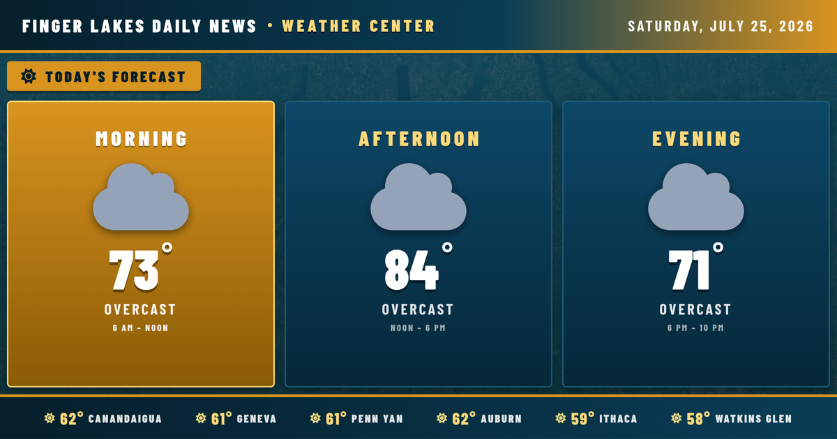
Sunrise is still a few minutes away, and the Finger Lakes are sitting under clear skies with temperatures in the upper 50s to low 60s — a comfortable enough Saturday morning before the pattern starts a gradual shift that will define the rest of the week. The high-pressure system that delivered several days of fine summer weather has slipped eastward into New England, and a southerly return flow is already pumping humidity back into the region.
This morning stays pleasant. Temperatures climb through the 70s under increasing clouds, reaching highs near 84° in Geneva, Auburn, and Canandaigua, and touching 86° in Ithaca and Watkins Glen by early afternoon. Winds stay light — mostly southerly at 4 to 8 mph — so the humidity will be noticeable but not oppressive. Skies go mostly overcast through the afternoon, though rainfall today looks minimal, with precipitation chances sitting around 7%.
Overnight, lows settle back near 61° in Geneva, with the southern valley towns like Corning and Bath dipping to around 56°.
Sunday brings a higher chance of showers, around 20%, with clouds lingering and highs remaining near 83°. The more significant unsettled period arrives Monday and Tuesday as moisture deepens and shower and thunderstorm coverage increases — Tuesday carries an 80% precipitation chance, with highs dropping to 78°. Wednesday and Thursday continue with chances for drizzle and showers as an upper-level trough pushes cooler air through the region, highs falling to the mid-70s. There’s light at the end of the tunnel: Thursday into the weekend looks to dry out, with mainly clear skies and highs recovering into the low 80s by Friday.
Weather Center forecast for the Finger Lakes region. Sourced from NWS, Open-Meteo, NWS Area Forecast Discussion, and USGS stream-flow data. Updated 6 AM, noon, and 6 PM ET.