


The Weather Center clock reads 6:30 AM and the Finger Lakes are putting on a genuinely fine morning — clear skies from Auburn to Corning, temperatures in the mid- to upper 50s, and a light westerly breeze keeping things comfortable before what should be one of the better afternoons of the month. Enjoy it. A wetter stretch is on the way.
This morning will be pleasant across the board, though NWS Buffalo flags the possibility of patchy river valley fog in the Southern Tier early — Corning and Elmira, sitting at 54° and 55° respectively with humidity near 90 percent, are the most likely candidates. That fog, if it develops at all, should lift well before midmorning.
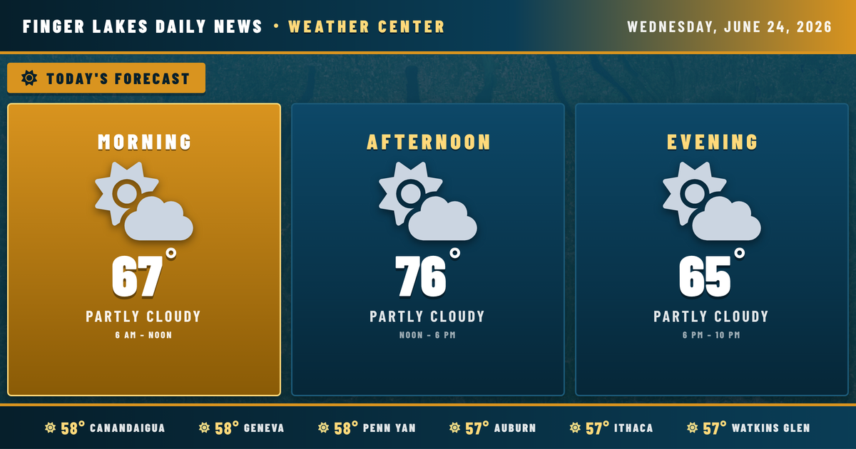
The afternoon turns out beautifully. Skies stay mostly sunny to partly cloudy, with highs reaching the mid- to upper 70s — Geneva and Auburn top out near 76°, while Ithaca and Watkins Glen push closer to 78° to 79° given their inland positions. Light winds stay in the 6 mph range all day. This is a late-June afternoon worth getting outside for.
Evening stays dry and comfortable, with temperatures easing back through the 60s. Overnight lows settle around 57° in Geneva, with the southern-tier valleys a few degrees cooler — Bath and Corning dropping to 53°.
Thursday is where the pattern changes. A shortwave tracking through the Great Lakes trough brings increasing shower and thunderstorm chances through the day. NWS Buffalo has flagged a marginal severe risk for the western Southern Tier on Thursday — damaging gusts are the primary concern there, not a high-end threat but worth watching. Friday stays unsettled with lingering drizzle and highs still in the upper 70s.
The weekend looks notably warmer — Saturday climbs to the mid-80s before a hotter, stormier Sunday approaches 90° in Geneva. That Tuesday-through-Friday unsettled spell may feel brief by the time the heat builds back in.
Weather Center forecast for the Finger Lakes region. Sourced from NWS, Open-Meteo, NWS Area Forecast Discussion, and USGS stream-flow data. Updated 6 AM, noon, and 6 PM ET.