


Tonight’s one of those late-June evenings worth noting — the Weather Center has Geneva sitting at 75° under a partly cloudy sky, with a light northwest breeze keeping humidity in the mid-40s. It’s about as comfortable as the season gets. Enjoy it: the pattern shifts overnight.
A weak warm frontal segment will push into the region very late tonight, and showers will spread westward to east by Thursday morning. Overnight lows will settle in the upper 50s across most of the lakes — Geneva, Auburn, and Canandaigua around 57°, with the southern valleys near Corning and Bath dipping a few degrees cooler into the low-to-mid 50s. No frost threat tonight.
Thursday turns unsettled. A cold front arrives Thursday afternoon and evening, bringing another round of showers and possibly embedded thunderstorms. The NWS Buffalo office flags an isolated risk of stronger storms, particularly across the western Southern Tier, with damaging winds the primary concern. Keep an eye on the afternoon forecast if you have outdoor plans.
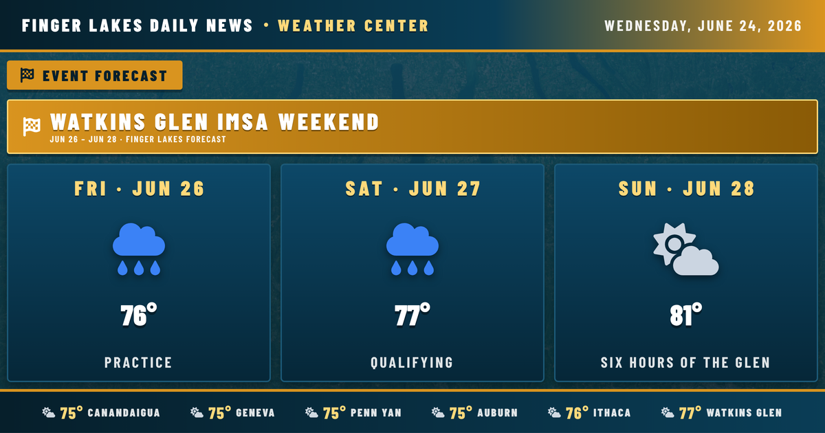
Looking ahead to the IMSA weekend at The Glen: Friday and Saturday carry lingering drizzle chances, but Sunday’s Six Hours of the Glen currently looks mainly clear with a high near 81°. The warm-up continues strongly into next week, with highs climbing through the mid-to-upper 80s and touching 90° by Tuesday.
Weather Center forecast for the Finger Lakes region. Sourced from NWS, Open-Meteo, NWS Area Forecast Discussion, and USGS stream-flow data. Updated 6 AM, noon, and 6 PM ET.