


I’m watching a slow-moving cold front that’s going to make for a tale of two weekends — one gorgeous, sun-drenched Thursday today, and a much wetter Saturday on the other side of it. Savor today while it lasts.
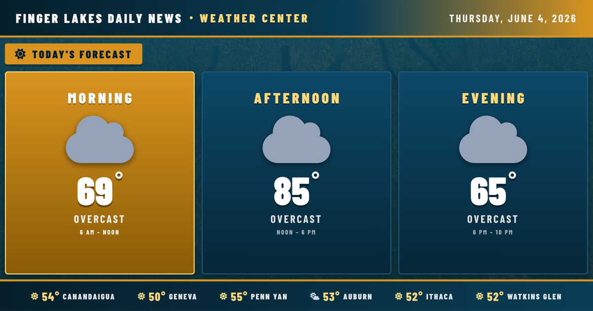
This morning is as pleasant as June gets. Skies are clear across the region, temperatures are in the low 50s from Geneva to Watkins Glen, and a light southerly breeze is already in place. That south wind is doing the early work of pulling warmer air northward, and it’ll keep going all day.
By afternoon, highs reach the mid-80s nearly everywhere — Geneva and Ithaca both top out near 85°, Watkins Glen could touch 86°. Canandaigua and Auburn will be right in that range as well. Humidity remains comfortable through the afternoon despite the warmth. Skies will cloud over through the evening as moisture begins to funnel in ahead of the approaching system.
Overnight, clouds thicken further with temperatures holding in the upper 50s. No rain tonight, but the setup is clearly building.
Friday stays dry but turns noticeably muggier, with highs pushing toward 89° in Geneva — the peak of this warm spell. Then the front arrives. According to the NWS Buffalo office, a weak surface low will track just north of the region late Friday through Sunday, dragging a slow-moving cold front across the area. Showers and thunderstorms are likely Saturday, with some storms capable of heavy downpours and gusty winds. The Storm Prediction Center has flagged a marginal risk for excessive rainfall Saturday, though stream flows are running seasonably low right now, so flooding isn’t a major concern.
Looking ahead: Sunday brings lingering drizzle and clouds with highs around 72°, then drier and more comfortable conditions return next week, with highs back in the upper 70s by Tuesday and Wednesday.
Weather Center forecast for the Finger Lakes region. Sourced from NWS, Open-Meteo, NWS Area Forecast Discussion, and USGS stream-flow data. Updated 6 AM, noon, and 6 PM ET.