The National Weather Service has confirmed that an EF1 tornado and a powerful microburst struck parts of the Southern Tier during Saturday’s severe weather outbreak.
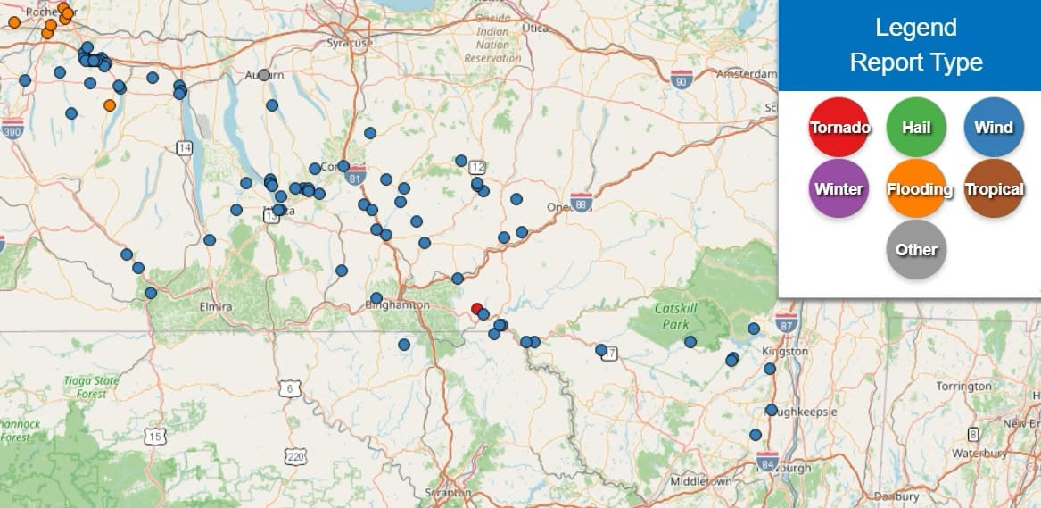
Following a storm survey conducted Sunday, meteorologists determined an EF1 tornado with peak winds of 95 mph tracked nearly 15.7 miles from the southeastern corner of Broome County into southern Delaware County. The tornado also briefly affected the far northern border of Wayne County, Pennsylvania.
The survey also confirmed an intense microburst with estimated peak winds of 105 mph. The damaging wind event measured approximately seven-tenths of a mile long and three-tenths of a mile wide.
The National Weather Service said Saturday’s storms produced widespread damaging winds across the region. Another microburst with estimated winds of 70 to 80 mph struck the Marathon area in Cortland County before damaging winds continued into northern Broome and Chenango counties.
Norwich was among the hardest-hit communities, sustaining significant wind damage. Survey teams also noted tree damage in northern Susquehanna and Wayne counties in Pennsylvania.
The National Weather Service continues to assess damage from Saturday’s storms as cleanup efforts remain underway across the region.