


Special Weather Statement in Southern Cayuga, Yates, Seneca has ended. All weather alerts for the Finger Lakes region have cleared.
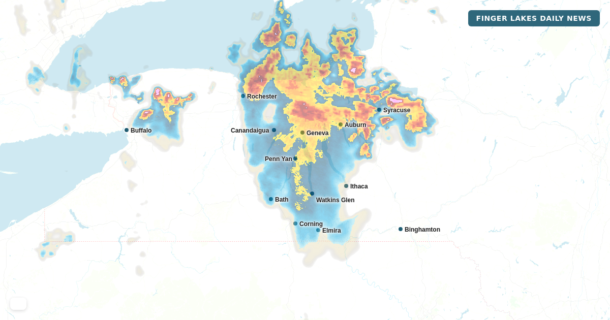
A strong thunderstorm moving northeast across southern Cayuga County is bringing wind gusts up to 50 mph to Auburn, Van Buren, Weedsport, and surrounding areas. The storm was tracked by radar near Weedsport at 9:24 p.m. and is moving toward Baldwinsville and Solvay at about 15 mph.
Expect gusty winds to knock down tree limbs and scatter unsecured objects. If you're in the storm's path in Auburn, Seneca, or Yates counties, bring in outdoor items now and stay away from windows if the wind picks up. This warning expires at 10:15 p.m.
A strong thunderstorm is moving northeast through Yates and Seneca counties as of 8:40 p.m., tracking toward Seneca Falls and Waterloo. Wind gusts could reach 50 mph, with half-inch hail possible.
Gusty winds may knock down tree limbs and scatter unsecured objects. Hail damage to vegetation is possible but minor. If you're outdoors in Penn Yan, Fayette, Benton, or Union Springs, move indoors now. The storm is moving at 15 mph northeast, so impacts should pass within the next hour or so.