• Winter Storm Warning - Click for Details
    ...WINTER STORM WARNING IN EFFECT FROM 1 AM SUNDAY TO 7 PM EST MONDAY...
    Expires: January 26, 2026 @ 7:00pm
    WHAT
    Heavy snow expected. Total snow accumulations between 12 and 18 inches.
    WHERE
    Portions of central New York and northeast Pennsylvania.
    WHEN
    From 1 AM Sunday to 7 PM EST Monday.
    IMPACTS
    Travel could be very difficult to impossible. The hazardous conditions could impact travel on Sunday along with the Monday morning and evening commutes.
    ADDITIONAL DETAILS
    At this time, the heaviest snowfall is forecast to be from south-central NY and areas southward into Northeast PA and Catskills. However, further adjustments to the storm track are possible in the coming days. Snowfall could be very heavy at times Sunday through Sunday night with hourly rates exceeding 2 inches per hour.
    PRECAUTIONARY/PREPAREDNESS ACTIONS
    If you must go outside, dress in layers. Several layers of clothes will keep you warmer than a single heavy coat. Cover exposed skin to reduce your risk of frostbite or hypothermia. Gloves, a scarf, and a hat will keep you from losing your body heat. Persons should consider delaying all travel. Motorists should use extreme caution if travel is absolutely necessary.
  • Cold Weather Advisory - Click for Details
    ...COLD WEATHER ADVISORY REMAINS IN EFFECT FROM 7 PM THIS EVENING TO 10 AM EST SATURDAY...
    Expires: January 24, 2026 @ 10:00am
    WHAT
    Very cold wind chills as low as 15 to 25 below expected.
    WHERE
    Portions of central New York and northeast Pennsylvania.
    WHEN
    From 7 PM this evening to 10 AM EST Saturday.
    IMPACTS
    The dangerously cold wind chills as low as 15 to 25 below zero could cause frostbite on exposed skin in as little as 30 minutes. Frostbite and hypothermia will occur if unprotected skin is exposed to these temperatures.
    PRECAUTIONARY/PREPAREDNESS ACTIONS
    Use caution while traveling outside. Wear appropriate clothing, a hat, and gloves. Keep pets indoors as much as possible. Make frequent checks on older family, friends, and neighbors. Ensure portable heaters are used correctly. Do not use generators or grills inside.

WGVA 106.3FM 1240AMMix 98.5101.7 The WallWFLR Finger Lakes Country Classic Hits 99.3The Lake 100.1/104.5 WAUB 96.3FM 1590AM

Bitter Cold Air Arrives Today; Snow Storm This Weekend

SHARE NOW

The Finger Lakes region is bracing for a powerful round of winter weather that could bring dangerous cold, lake-effect snow, and a significant weekend storm.

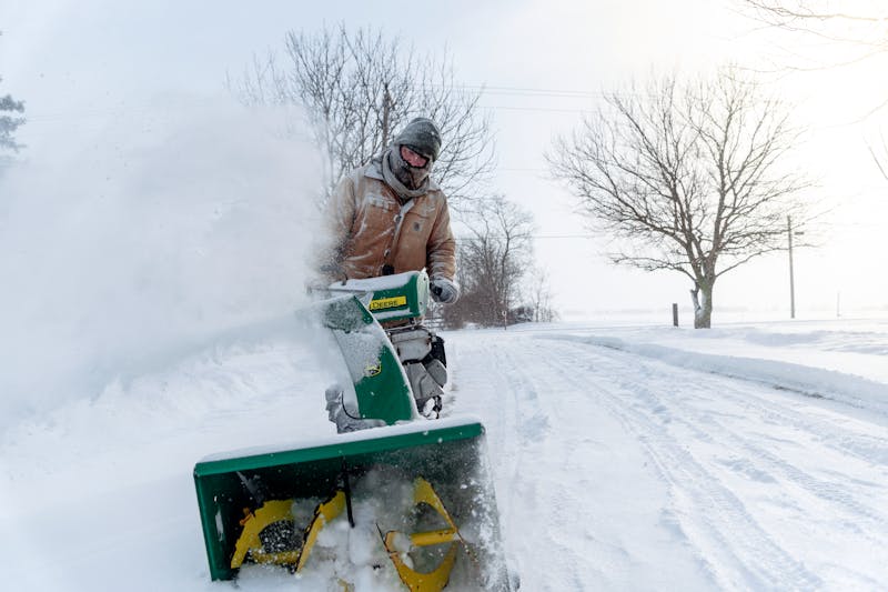
On Friday’s FLX Morning, Meteorologist Kevin Williams said the first blast arrives today as Arctic air moves into the region, sending temperatures sharply downward. By the end of the day, highs are expected to fall to around four degrees, with wind chills dropping to nearly 15 degrees below zero.

Williams warned that those conditions can become dangerous for anyone spending time outdoors without proper winter clothing, including pets.

In addition to the bitter cold, lake-effect snow is expected to develop later tonight and continue into Friday. While lake-effect bands often stay north of the Thruway, Williams says snow could spread south into the Route 5 and 20 corridor, including Auburn, Seneca Falls, and surrounding communities. Several inches of light accumulation are possible in parts of Wayne, northern Cayuga, northern Seneca, and northeast Ontario counties.

The second and more significant round of weather arrives this weekend as a major storm system moves north from the southern United States. Snow is expected to begin Sunday morning and continue through Sunday night and into Monday.

Early forecasts call for widespread snowfall across the Finger Lakes, with totals in the range of 10 to 18 inches by the time the system moves out.

Residents are being urged to prepare for hazardous travel conditions and extreme cold, and to monitor forecasts as the storm system continues to develop.

A reminder that we will post any weather-related closings and cancellations we receive throughout the storm to our homepage 

Get the latest Finger Lakes headlines and stories every morning FREE in your email! Subscribe today!